Harzer-Hexen-Stieg - 2nd stage - from Buntenbock to Torfhaus


- 5:30 h
- 21.94 km
- 582 m
- 347 m
- 556 m
- 804 m
- 248 m
- Start: Buntenbock
- Destination: Torfhaus
Do you know the “Sperberhaier Damm”? The impressive hand-built structure once served to supply water to the Clausthal mines, just like the numerous ponds, ditches, and waterways (= underground canals) of the UNESCO World Heritage "Upper Harz Water Management System".
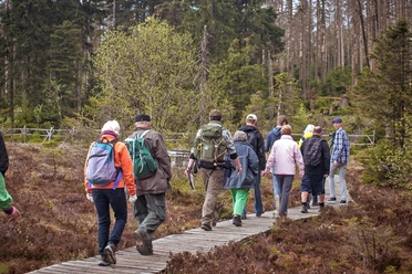
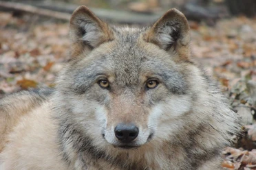
The mine entrances, entry and exit points of water to the underground, are still partly recognizable. Look out for the “Dennert-Tanne”, the typical yellow Harz information boards shaped like a conifer tree, the building material of the miners. Passing Altenau, we enter the Harz National Park. With some luck, we might encounter a shy lynx – the king of the Harz forests, which has been reintroduced here. Get information at the Torfhaus National Park Centre and join a hike with a National Park ranger.

Good to know
Best to visit
Directions
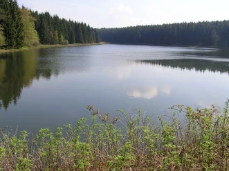
From now on, water determines our path. The UNESCO World Heritage "Upper Harz Water Management System" today consists of over 90 ponds, almost 100 kilometers of water ditches, and numerous historic structures. Once, water powered water wheels that transported ore to the surface and drained the mines. From the precipitation-rich Brocken, it was distributed throughout the Upper Harz. Clausthal and Altenau, as well as St. Andreasberg at the Brocken bypass of the Harzer-Hexen-Stieg, were free mining towns. They had market and grazing rights, and inhabitants were exempt from military service for their lord. The water rights described the right to divert and use water for mining purposes.
Huttaler Widerwaage, Polsterberger Hubhaus, Sperberhaier Damm, Grabenhaus Rose, Dammgraben … On many information panels along the way, the structures of the Upper Harz Water Management System are lovingly and detailedly described. This way, the historic mining industry comes alive again, accompanying us at every step.
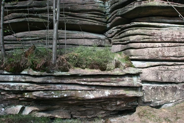
Behind Altenau, still within the mining catchment area, we enter the Harz National Park. Only at Drei Annen Hohne will we leave it again. The witch symbol on the impressive wooden signposts now marks the route. The spruce forest still stands dense, but more and more toppled giant trees with their root plates over a meter high blend into the scene. Here, nature is allowed to be nature again, the forest remains untidy. We follow the Dammgraben to its beginning and then climb a bit steeper to Torfhaus, the stage destination.
Additional information
The Harzer-Hexen-Stieg is supported by Harz Energie, the savings banks along the way, and Blankenburger Wiesenquell.
Literature
Author´s Tip / Recommendation of the author
Not directly on the route, but the detour is worth it: The Polsterberger Hubhaus today houses a very nice forest inn. The products on the seasonal menu all come from the region. Particularly delicious are the fresh and homemade cakes.
Opening hours
June to October: Daily from 11 a.m. to 7 p.m.
November to May: Wednesday to Sunday from 11 a.m. to 7 p.m.
and by appointment
Contact
Beate Engel, Polsterberg 1, 38678 Clausthal-Zellerfeld
Phone 05323 5581, Fax 05323 715507
polsterberger-hubhaus@harz.de, www.polsterberger-hubhaus.harz.de
Map
Nearby