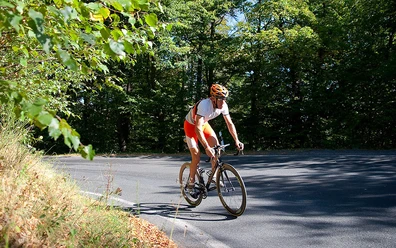
Thale 115km (to Braunlage)
- 4:30 h
- 115.27 km
- 1,904 m
- 1,922 m
- 153 m
- 627 m
- 474 m
- Start: Thale, Braunlage
- Destination: Thale, Braunlage
Thale - Roßtrappe - L93 - Wienrode - Cattenstedt - Blankenburg - Hüttenrode - B27 - Rübeland - Elbingerode - Nöschenrode - Hasserode - Drei Annen Hohne - Elend - B27 - Braunlage - B4 - Hohegeiß - Benneckenstein - Trautenstein - B242 - Hasselfelde - Stiege - Allrode - Treseburg - Thale

Good to know
Best to visit
Directions
Once at the top, we turn right and follow the road via Wienrode and Cattenstedt to Blankenburg. We follow the long-distance traffic out of Blankenburg on the B27 towards Hüttenrode/Elbingerode. Already in the town, the approx. 6km ascent begins with sections up to 6%. Via Hüttenrode, we follow the B27 to Elbingerode. Here, we turn right onto the B244 towards Wernigerode over an approx. 2km climb to the Büchenberg. From here, it goes downhill via Nöschenrode to Wernigerode. Upon arrival there, we follow the signs towards Schierke over a long but rhythmically manageable climb. Shortly before Schierke, we turn left towards Elend. In the town, we turn right onto the B27, then enter the Upper Harz towards Braunlage. In the town center, we follow the long-distance traffic left over the partly busy B4 to Hohegeiß. At Hohegeiß, we turn left following the signs to Benneckenstein and follow the route via Trautenstein and the B242 to Hasselfelde and Stiege. In Stiege, we leave the B242 to the left and go via Allrode to Treseburg. Following the signs to Thale, we return over the Roßtrappe to our starting point.
Nearby


Download GPX file