10th route "My First Stamp Book"

- 1:05 h
- 3.94 km
- 92 m
- 92 m
- 224 m
- 308 m
- 84 m
- Start: Parking lot at the eastern edge of Steigerthal
- Destination: Parking lot at the eastern edge of Steigerthal
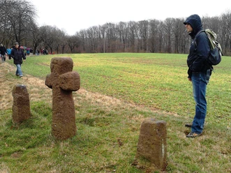
The Glockensteine are located southwest of the small village of Steigerthal at a crossroads of the Karst hiking trail and the hiking trail to the Nordhausen district Himmelgarten.
This route is part of the booklet "My First Stamp Book" from the Harzer Wandernadel, which includes stroller-friendly routes.
Once all 16 routes have been hiked and the booklet has been filled with stamps, you can reward yourself with the special hiking badge.

Good to know
Best to visit
Directions
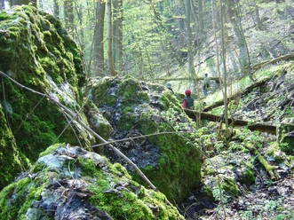
The hike starts at the parking lot at the eastern edge of Steigerthal. From there, turn onto the street "Hinter den Gärten". Follow this path for about 600 meters, then turn left onto the street "Zu den Glockensteinen". The hike leads onto a forestry road until you reach stamp station 198 Glockensteine after about 500 meters. Continuing straight on the Karst hiking trail, after about 300 meters turn left onto a field path, which you continue on the left after another 300 meters. You pass through the South Harz Nature Park for about 1 km and follow the Karst hiking trail to the left until you reach the street "Hinter den Gärten" and return to the starting point.
Nearby
Download GPX file