Karstwanderweg - circular route 25 around the Iberg


- 1:05 h
- 3.32 km
- 127 m
- 128 m
- 437 m
- 564 m
- 127 m
- Start: Parking lot of the Cave Experience Center (HEZ) on the B 242
- Destination: Parking lot of the Cave Experience Center (HEZ) on the B 242
This not too long circular route leads continuously through forest. It is also the first or northern part of the Karstwanderweg. On the western Harz side, the Karstwanderweg begins at the Cave Experience Center in and on the Iberg near Bad Grund. In the building, finds and evidence as well as a replica of the Lichtenstein Cave (circular route 24) are exhibited; thus the real Lichtenstein Cave, located between Dorste and Förste and once the grave of a Bronze Age extended family, is connected with the exhibition of the results of cave archaeology in the HEZ.
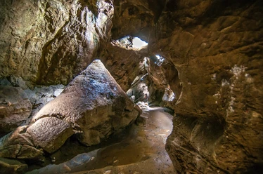
The Iberg is the mother of the mining town, iron ore was mined here for thousands of years until 1885, later also base metal ores. The 385 million-year-old coral reef from Devonian limestone is heavily karstified and houses numerous caves. Today the Iberg is strictly protected as an FFH area; the near-natural forest with beech and noble deciduous trees as well as the rare yew is left to itself. Now the route leads up to the Iberg plateau. A viewpoint with information boards broadens the view over the largest quarry in Lower Saxony. Shortly behind, boards provide information about the archaeological research of the early history of mining on the Iberg.
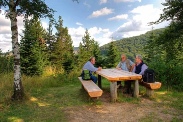
At the Iberg Albert Tower, there is a place to rest and panoramic views from the tower. Across the Iberg plateau, the route gently descends on an old forest path to the Bismarck Cliff. On the further descent, the path turns at an autochthonous occurrence of the yew tree, a tree species typical for this substrate and climate but now rare. It is unclear whether the name "I"berg is just a contraction of yew (Ibe) or iron (Isen). Caution: risk of falling; do not leave the path! The Karstwanderweg connects to this circular route.
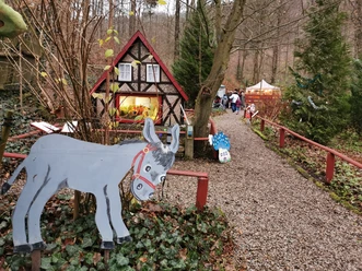
First the path goes below the parking lot into the Devil's Valley, where for children the Fairy Tale Ground soon awaits to the left. To the right is the entrance to the iron ore mine. Iron ore was mined here until 1885. Today, the extensive mine, reaching down below the karst groundwater in the Iberg – simultaneously the drinking water of Bad Grund – contains the healing tunnel for the treatment of lung diseases. The path leads west below the B 242, with the Iberg settlement on the left, built in 1938 mostly for South Tyrolean workers in the limestone quarry established at the same time. The Hübichenstein is a double rock needle made of reef limestone, already climbed by Goethe on August 12, 1784. The climb is worth it for the nice view over Bad Grund and the Iberg. Deeper in the rock are old iron ore mines. It is said that Hübich, king of a legendary dwarf people, lived here (or still lives?).

Good to know
Pavements
Best to visit
Directions & Parking facilities
Parking lot of the Cave Experience Center
The Cave Experience Center (HEZ) is a stop on bus line 460 with connection to the DB to Gittelde and Osterode
Additional information
Map
Nearby


Download GPX file