Through the Himmelreich


- 2:12 h
- 8.09 km
- 104 m
- 104 m
- 255 m
- 332 m
- 77 m
- Start: Walkenried Train Station
- Destination: Walkenried Train Station

Good to know
Pavements
Best to visit
Directions
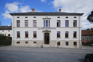
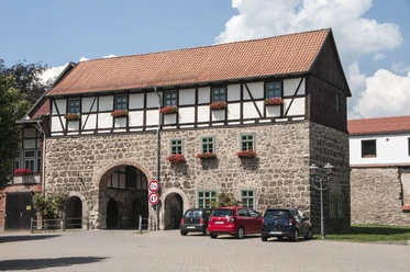
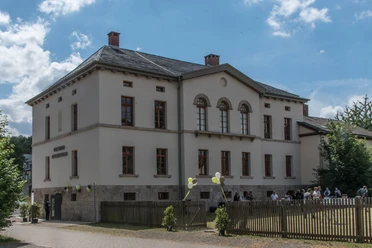
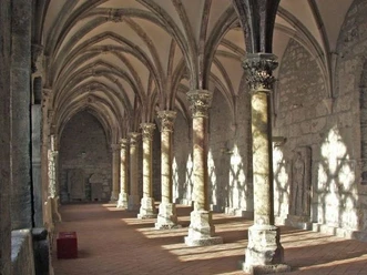
This route combines the signposted karst hiking trail between the monastery and the Itelteich into a circular route. Initially, you walk for 10 minutes along the village street to the Romanesque gatehouse, where the district of the former Cistercian monastery Walkenried begins. Today, a cultural tourist highlight is housed here, the Cistercian Museum Monastery Walkenried. It was opened in 2006 as one of the largest and most innovative monastic museums in Europe. Beyond the usual presentation paths, visitors embark on a fascinating journey through time via the fully preserved cloister buildings from the 13th century, where Middle Ages and monastic life come alive again through acoustic and visual staging. In summer, the well-known Walkenried cloister concerts take place here.
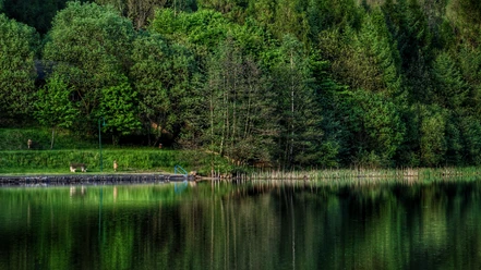
Walk clockwise around the monastery buildings and the impressive church ruins, along the right bank of the Wieda, then over the museum car park located by the former monastery wall and further to the road bridge. The path leads over this bridge to the Itelteich. In the Middle Ages, the Walkenried monks dammed a large sinkhole (polje) with a karst spring and a disappearing stream, creating a fish pond. Today, this is a technical monument and a part of a nature reserve, a paradise for waterfowl and many other animal species. Mighty old beeches line the path up the hill above the railway track, where the 300 m long Walkenried tunnel built in 1868 disappears. Beneath us lies the largest natural cavity in Germany, the Himmelreich cave (not accessible). The Himmelreich with its species-rich deciduous forest vegetation reveals beautiful distant views to the west and from the small Hexentanzplatz (stamp station!) with its columbine stands over Ellrich to the east. From here, the path leads down again into the Wieda valley past the majestic Itel cliffs lined with gnarled old trees.
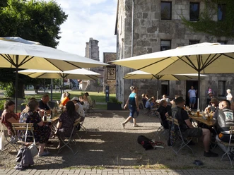
Heading south, the hiking trail crosses the wooded Wieda floodplain on the southern road bridge. In dry months, the river often dries up here due to the karstified underground. At the foot of the Röseberg with its gypsum cliffs and moist ravine forest vegetation, the route returns past more ponds to the former monastery district. At the latest on the way back, the Cistercian Museum invites you for a visit and several guesthouses offer coffee and cake, also outdoors in summer.
Nearby


Download GPX file