Buntenbocker Mountain Meadows Trail


- 1:50 h
- 7.29 km
- 78 m
- 83 m
- 526 m
- 571 m
- 45 m
- Start: At Kurpark Buntenbock
The Upper Harz mountain meadows represent a unique ecosystem in northern Germany, which stabilized over several centuries following its formation as a result of mining. This ecosystem is currently maintained through conservation efforts or agricultural use. The mountain meadows originated with the settlement of miners at the end of the 12th century through clear-cutting and subsequent private use of the land for grazing cattle and winter fodder production. At that time, almost every household in Buntenbock had red cattle and/or goats for self-sufficiency. The village animals were gathered by herders and driven to the meadows in spring and after the hay harvest. For the rest of the grazing season, forest grazing was practiced.
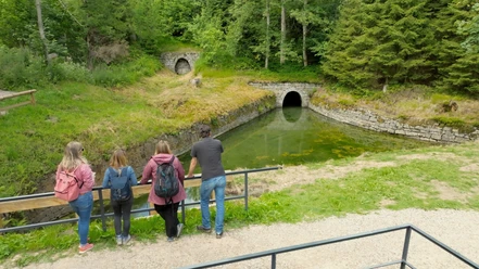
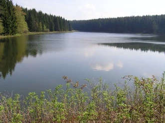
Today, you can relax at the beautiful mountain meadows: on a walk along the "Buntenbocker Bergwiesenweg," consisting of several circular routes and well signposted, you will discover lush green meadows and slopes covered with countless brightly blooming flowers, enchanted by the scents of nature. Wonderful views of the surrounding mountain ranges and quiet lakes and ponds, which are part of the UNESCO World Heritage Upper Harz Water Management System, await you! The "Buntenbocker Bergwiesenweg" is a conservation project by the Harz Club Branch Buntenbock, realized with support from the Hermann Reddersen Foundation of the Harz Club and private donations.

Good to know
Pavements
- Asphalt (53%)Trail (13%)Path (32%)Gravel (2%)
Best to visit
- suitableDepends on weather
Directions & Parking facilities
- Parking
Parking lot at Kurpark Buntenbock diagonally opposite the fire station
Additional information
- Tourist Information Buntenbock
At Schwarzenbacher Pond
Schwarzenbacher Str. 19
38678 Clausthal-Zellerfeld
Tel.: +49 (0) 5323 7128960
Fax: +49 (0) 5323 83962
E-Mail: info@oberharz.de
Nearby

Download GPX file