- 3:30 h
- 10.11 km
- 356 m
- 356 m
- 235 m
- 590 m
- 355 m
- Start: Romkerhall
- Destination: Romkerhall

Harz: Magische Gebirgswelt
Pavements
- Gravel (19%)Trail (24%)Asphalt (48%)Street (8%)Unknown (1%)
Best to visit
- suitableDepends on weather
Directions
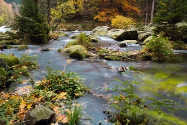
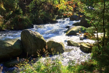
- Romkerhall is a popular excursion destination five kilometers south of the Goslar district Oker. The Romkerhall waterfall is considered the highest artificial waterfall in the Harz. This is where the hike begins. It leads over the Kleiner Romke – an outcrop of the Huthberg – and continues to the Fig Tree Cliff, the Mousetrap and finally to the Witch’s Kitchen. In the immediate vicinity, there is a group of granite rocks at about 600 meters above the Oker valley – the Käste Cliffs. They offer an excellent view of the Oker valley and the northern Harz foreland. Their current shape was formed by the so-called "wool sack weathering." This type of weathering shapes solid rock into rounded blocks. You follow the Käste Road over the Ziegenrücken Cliff to the Waldhaus Okertal. From there, you hike over the Eagle Cliffs to the Engagement Island in the Oker valley and back to Romkerhall.
Equipment
- Sturdy footwear is recommended.
Directions & Parking facilities
- Getting thereFrom Goslar towards Oker and then on the B498 towards Okertal.ParkingParking lot at the waterworks next to the Hotel-Restaurant RomkerhallPublic transportationFrom Goslar take bus line 801 to the stop Waldhaus Okertal and then continue on foot for 4 km to the Kingdom of Romkerhall.
Additional information
- Harzklub branch association Oker e.V.
http://www.harzklub.de/zweigvereine/oker.htmlTourist Information Goslar
Markt 7, 38640 Goslar
Tel. 05321 78060
E-Mail tourist-information@goslar.de
www.goslar.de Safety guidelines
- For the viewpoints at the cliffs, a head for heights and sure-footedness are sometimes required.