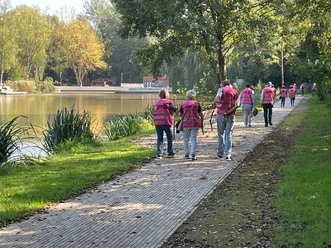
Circular route around the Schanze (RW7)

11.99 km long
Round trip
Difficulty: medium
Condition: medium
Walking / hiking
  • 3:20 h
  • 11.99 km
  • 311 m
  • 311 m
  • 124 m
  • 238 m
  • 114 m
  • Start: Information board at the parking lot on Hildesheimer Str. Hildesheimer Str.
  • Destination: Like start
A little history, cozy river valleys, but above all wide, open views over the Harz and Heberbörde shape the path.

An varied hike awaits us at the edges of the Harz and Heberbörde. The path often winds along the forest edge with magnificent panoramic views. It dips into romantic river valleys, passes through a quarry long reclaimed by nature, and the climb in the hollow way of the old Braunschweig military road lets us imagine how arduous travel was in the old days. The hiker can also expect some secrets: puzzling over the wedding dress under the wedding stone or feeling a bit daunted by the missing captain in the Kaldaunengasse. With some luck, you can even find some fossils at Sonnenbleek. Anyone who wants to enjoy the view at every one of the numerous benches should naturally allow more time for the hike. Especially if you also want to take advantage of the good eateries in Wolperode or Brunshausen.
Waymarking: red 7 on a white rectangle

Good to know

Best to visit

suitable
Depends on weather

Directions

At the edge of the parking lot we cross the Gande, soon switching again to the left side of the Eterna and hike upstream until the forest ends. From there we go left to the former shooting range. From here left uphill to a forest road, from which you go right to the rest area at the old memorial. At the forest edge, we briefly descend, turn left at the next intersection and keep right on a path that soon leads into a forest road. We go downhill along this, past the rest area “Köhlerhütte” to the next crossroads. Now we hike left uphill in a hollow way. At a sharp left curve, we go straight into the forest and descend into the valley of the “Fällerwasser,” crossing a bridge to the road. Here we continue left to the wedding stone. At the stone, we turn left and climb a narrow path that soon reaches a field path that we follow left to the Steinbrink intersection. We continue right to the forest edge and here on the right on a path to an asphalt road on the north side of the ridge. We follow this left to Wolperode. In the village we pass the church to the main street. Here left and then again left uphill to the edge of the village. Here briefly right and then left on a grassy path to the forest edge. From there right to the corner of the forest and straight on to a turning area. Here we follow a narrow path along the forest edge that leads to a forest path. We continue right on this and at the next intersection then downhill left until at the following intersection we keep right and reach a large forest road, which we follow a short stretch left until a narrow path descends right into the Gande valley. The path reaches the Philosophenweg, which leads us left into the town.

Directions & Parking facilities

Arrival by car

From the south: A 7 towards Hannover, exit 68 Echte, direction B 445 Bad Gandersheim/Kreiensen.

From the north: A 7 towards Kassel, exit 67 Seesen/Harz, direction Seesen/Osterode/Bad Gandersheim.

Free parking at the starting point

Arrival by car

Arrival by train

From Hannover: Metronom to Kreiensen. Change to the regional train to Bad Harzburg. From Göttingen: Metronom to Kreiensen. Change to the regional train to Bad Harzburg.

Safety guidelines

Unlike described in the official hiking map, this route passes through Wolperode without waymarks. The RW 7 waymarks start again at the forest edge.

Map

Bike and hiking map Bad Gandersheim scale 1:25,000 price: €3.50

Sale: Tourist Information Bad Gandersheim

Nearby