Through forest and field to Heckenbeck (RW 6)

13.22 km long
Round trip
Difficulty: medium
Condition: easy
Walking / hiking
  • 3:40 h
  • 13.22 km
  • 301 m
  • 301 m
  • 125 m
  • 245 m
  • 120 m
  • Start: Information board at the parking lot on Hildesheimer Str. (N 51°52.479´ E.
  • Destination: Same as start
A hike to a village in transition

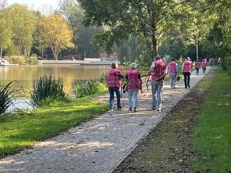
The trail leads over the Wilhelm Tower in the species-rich Cluswald, past the burial mounds, to Heckenbeck (grave of Albert Gottlieb Methfessel). An exceptional village and population structure characterizes the old village. It is worth exploring. Beautiful, old orchards, the floodplain of the Mahmilch River, and repeatedly wonderful views impress the hiker.

Harz: Magische Gebirgswelt

Good to know

Pavements

Unknown (5%)
Asphalt (16%)
Gravel (42%)
Trail (35%)
Street (3%)

Best to visit

suitable
Depends on weather

Directions

On the right side of Hildesheimer Straße, head towards the city center, until on the right a path leads up to the street "Unter dem Hagenberg." We follow it a short way to the right and before a left curve, climb a narrow alley to the lower Teppichweg. We continue uphill along this path to Clusgasse and soon reach Wilhelm Tower. Passing the tower, continue on a forest trail which soon meets the "Sternplatz." Here, we leave the wide forest road on the left and follow an unpaved forest path to the junction at the burial mounds. A few steps from there bring us to the forest edge, where we continue our hike along the scenic forest edge path until we can descend left onto an asphalt field path leading to the district road. We follow it a short distance to the right and then turn left at the first houses of Heckenbeck. We follow the ascending path, which first leads through open fields and then through a countryside finely structured by bushes and trees. At the next crossroads, we keep left and reach the district road via the idyllic Mahmilch floodplain. We follow it a short way to the right and then ascend to a scenic hillside path on the left, which takes us comfortably to the settlement boundary. From here, we head up the apple path on the left. We cross Clusgasse and are back on the lower Teppichweg, which we leave to the right after about 200 meters and walk through beautiful meadows along the forest edge towards the city. Via Wiekweg, past the hospital, we reach our starting point again.

Directions & Parking facilities

Arrival by car

From the south: A 7 towards Hanover, Exit 68 Echte, direction B 445 Bad Gandersheim/Kreiensen.

From the north: A 7 towards Kassel, Exit 67 Seesen/Harz, direction Seesen/Osterode/Bad Gandersheim.

Parking:

Free parking lot at the starting point

Arrival by train

From Hanover: Metronom to Kreiensen. Change to the regional train to Bad Harzburg. From Göttingen: Metronom to Kreiensen. Change to the regional train to Bad Harzburg.

Safety guidelines

Trail marker: red 6 on white rectangle

Map

Bike and hiking map Bad Gandersheim 1: 25,000

available at the tourist information of the city of Bad Gandersheim

Price: €3.50

Nearby