"The Hidden Village" Circular Hiking Trail Bad Gandersheim – Ellierode RW 4


- 3:40 h
- 13.48 km
- 156 m
- 157 m
- 127 m
- 283 m
- 156 m
- Start: Information board at the parking lot on Hildesheimer Str.
- Destination: Same as start
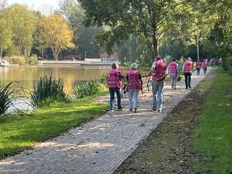
On this path we circle the Abbess Hill and look for the hidden village of Ellierode, which initially remained unoccupied in 1945 because the Americans had overlooked the small town. In addition to the magnificent views that this hike offers us in abundance, we can observe flight operations on summer weekends at the Kühler.

Good to know
Pavements
Best to visit
Directions
Our path merges into the road "Am Hackelberg" in Ellierode. Here we keep left and ascend past the cemetery to the nearby forest edge. A forest edge path now leads us back to the outskirts of the village. An unpaved forest path soon joins the well-maintained Abbess Hill path, which we follow to the end of the forest. We walk down a field path and return via Wrescherode and the campsite back to Bad Gandersheim.
Directions & Parking facilities
Arrival by car
From the south: A7 towards Hanover, exit 68 Echte, direction B 445 Bad Gandersheim/Kreiensen.
From the north: A7 towards Kassel, exit 67 Seesen/Harz, direction Seesen/Osterode/Bad Gandersheim.
Arrival by train
From Hanover: Metronom to Kreiensen. Change to the regional train to Bad Harzburg. From Göttingen: Metronom to Kreiensen. Change to the regional train to Bad Harzburg.
Literature
Safety guidelines
Trail marker: red 4 on white rectangle
While the trail markers in the city lead straight ahead behind the railway underpass, we take the nicer path to the left.
On the way back: Caution when crossing the B 64 in front of the campsite!
Map
Bike and hiking map Bad Gandersheim 1: 25,000
available at the Bad Gandersheim tourist information center
Price: €3.50
Nearby


Download GPX file