Harzer-Hexen-Stieg - 4th stage northern variant - from Drei Annen Hohne via Rübeland to Altenbrak


- 7:30 h
- 28.94 km
- 226 m
- 492 m
- 300 m
- 542 m
- 242 m
- Start: Drei Annen Hohne
- Destination: Altenbrak
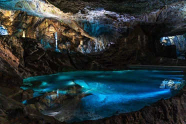
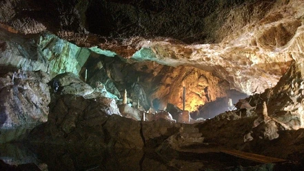
The highlight of this stage is, on the one hand, the cave town of Rübeland with the famous dripstone caves, the Herrmann and the Baumann caves. You should take the time for at least one of the two world-famous dripstone caves. If you stay overnight here, visiting the cave festival is a natural choice. On the other hand, you experience the Rappbode reservoir, with the 106-meter-high gravity dam. In comparison, the dam of the Wendefurther reservoir, where there is an information center, is almost delicate.
Good to know
Best to visit
Directions
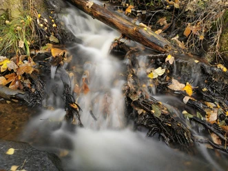
From Drei-Annen-Hohne, the trail goes down the Steinbach valley. A first break can be taken at the rustic waterfall on the outskirts of Königshütte. On the Hexen-Stieg we then pass through the small Harz village and soon reach the point where the path splits into northern and southern routes. The Rappbode reservoir with its numerous arms is the reason.
Directly below the ruins of Königsburg, we keep left and follow the Warme Bode, which merges with the Kalte Bode after a few meters. The wide river floodplain that soon opens up already belongs to the system of the still distant Rappbode reservoir. At the abandoned mining settlement of Susenburg, it becomes narrower again and the path rises into the forest. At the Hoher Kleef viewing pavilion, it then again offers a magnificent panoramic view over the town of Rübeland up to the Brocken.
Otherwise, it continues through Rübeland always along the water, which widens again behind Neuwerk forming the Wendefurther reservoir. Now the Bode again turns into a lovely trout stream, which after a few bends reaches Altenbrak.
Literature
Safety guidelines
Map
Nearby

