- 2:00 h
- 19.06 km
- 443 m
- 443 m
- 202 m
- 481 m
- 279 m
- Start: Langelsheim station, Bahnhofstraße 24, 38685 Langelsheim
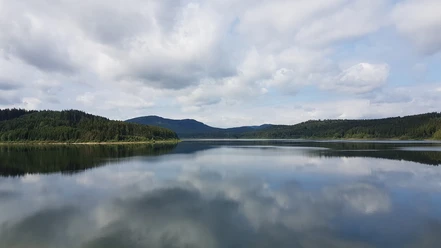
The short and easy beginner route initially runs along the edge of the Harz. Then a steeper trail ascent begins from the Innerste valley into the deciduous and mixed forests of the northern Harz. Over the dam wall of the Innerste dam the loop goes back to Langelsheim.

Pavements
- Asphalt (20%)Street (4%)Path (4%)Gravel (59%)Trail (13%)
Best to visit
- suitableDepends on weather
Directions & Parking facilities
- Public transportationThe MTB route L1 starts directly at Langelsheim station, not far away you can join MTB routes L2, L3 and L4 at the southern town exit towards Wolfshagen.
Additional information
The Volksbank Arena Harz is also available on YouTube.
Map
- The Harz for mountain bikers
Through the extremely varied North German low mountain landscape run 74 signposted mountain bike circular routes (total length 2,300 km), classified into three difficulty levels. Official map set “The Harz for mountain bikers”. Completely revised and expanded new edition. The new map set consists of a tourbook with detachable individual descriptions and detailed maps of the routes. In addition, there is a topographic overview map (1:50,000) on weatherproof and durable POLYART material.
ISBN 978-3-935806-28-2
Price 16.80 €
Publisher map solutions, Karlsruhe 2017