W10 Summit Route

- 4:00 h
- 40.83 km
- 907 m
- 908 m
- 544 m
- 1,141 m
- 597 m
- Start: Hotel Brockenscheideck, Brockenstraße 49, 38879 Schierke
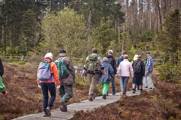
The route leads from Schierke via Brockenstraße up to the Brocken and down on its backside to Scharfensteinklippe, from where the next stage destination, the Eckertalsperre down in the valley, is clearly visible. The descent takes place on a slab path. At the Eckertalsperre, there are demanding trails offering views of the High Harz with the Brocken. From there, it goes gradually up to the Dreieckiger Pfahl and then again down a beautiful trail to Schierke. Attention: No signposting between Eckertalsperre and Dreieckiger Pfahl! Many hikers are on the entire route – please be considerate!

Good to know
Pavements
Best to visit
Directions & Parking facilities
Additional information
The Volksbank Arena Harz is also available on YouTube.
Map
The Harz for Mountain Bikers
Through the extremely varied North German low mountain landscape, 74 signposted mountain bike circular routes (total length 2,300 km) lead, classified into three difficulty levels. Official map set "The Harz for Mountain Bikers." Completely revised and expanded new edition. The new map set consists of a tour book with removable individual descriptions and detailed maps of the routes. In addition, there is a topographic overview map (1:50,000) on weatherproof and durable POLYART material.
ISBN 978-3-935806-28-2
Price 16.80 €
Publisher map solutions, Karlsruhe 2017
Nearby


Download GPX file