WasserWanderWeg Hirschler-Pfauenteich cascade


- 0:50 h
- 3.39 km
- 24 m
- 566 m
- 596 m
- 30 m
- Start: at B 242 Clausthal - Braunlage follow the sign "Hirschler-Pfauenteiche", turn right onto the Entensumpf parking lot
- Destination: Altenauer Straße in Clausthal-Zellerfeld
An easy circular route around the Hirschler-Pfauen ponds awaits you in Clausthal-Zellerfeld. On the 5 km long hike, you will pass many information boards. There, it is explained in detail how the ponds and water ditches were laid out above Clausthal-Zellerfeld.
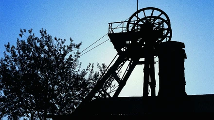
The Hirschler Pond and the 3 Pfauenteiche are mining ponds from the 16th and 17th centuries. Water for the Clausthal mines was collected in the ponds.
The 4 ponds lie one behind the other. The Hirschler Pond is at the top, the 3 Pfauenteiche lie like steps below the Hirschler Pond.
The 4 ponds supplied the Caroline and Dorothea mines with water. Both mines were located very high on the mountain. It was difficult to have as much water as possible up there every day.
The ditches and pond systems were therefore necessary for the energy supply in the mines. The ores mined underground had to be brought up. Rainwater that seeped into the mine also had to be pumped out of the galleries. Huge water wheels were responsible for this. They needed a lot of water all year round. The water was therefore collected in the ponds and led via the ditches to the water wheels.

Good to know
Pavements
- Path (89%)Gravel (11%)
Best to visit
- suitableDepends on weather
Directions
The circular route is 5 kilometers long. It starts at the federal road B 242 and goes directly to the Hirschler pond dam. From there, the path goes over the dam of the Upper Pfauenteich and past the Middle and Lower Pfauenteich.
Directions & Parking facilities
- Parking
Entensumpf parking lot
Additional information
Upper Harz Mining Museum
Bornhardtstr. 16
38678 Clausthal-Zellerfeld
Tel: 05323 98950
info@oberharzerbergwerksmuseum.de
www.oberharzerbergwerksmuseum.deUNESCO World Heritage Foundation in the Harz
Bergtal 19
38640 Goslar
Tel: 05321 750 114
info@welterbeimharz.de
www.welterbeimharz.deLiterature
Martin Schmidt: WasserWanderWege – A guide through the Upper Harz Water Regale – UNESCO World Heritage, 4th edition, Papierflieger Verlag GmbH, Clausthal-Zellerfeld 2012, ISBN 978-3-86948-200-2 UNESCO World Heritage - Rammelsberg Mine, Old Town Goslar and Upper Harz Water Management brochure in DIN lang format, presenting the associated tourist facilities along the Upper Harz water management with a short text and photos. On the back, there are three overview maps showing the World Heritage trails, the tourist destinations, and the overall location of the World Heritage. Price: 2.00 € Available at all tourist information centers in the region or online at shop.harzinfo.de.
Author´s Tip / Recommendation of the author
Very close by is the source of the river Innerste. The place is called Innerstesprung. It is only a few minutes from the parking lot. A short path before you start your hike.