- 4:40 h
- 87.81 km
- 1,200 m
- 1,200 m
- 173 m
- 607 m
- 434 m
- Start: Goslar - Kaiserpfalz car park (Kaiserbleek)
- Destination: Goslar - Kaiserpfalz car park (Kaiserbleek)
Goslar -> Astfeld (cycle path B82) -> Langelsheim -> Wolfshagen -> Seesen -> Münchehof -> Gittelde -> Badenhausen -> Osterode -> Lerbach -> Clausthal-Zellerfeld -> Schulenberg -> Oker -> Goslar

Best to visit
- suitableDepends on weather
Directions
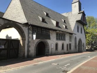
- Starting from the Kaiserpfalz in Goslar, following the long-distance traffic, the route leads out of Goslar onto Astfelder Straße (later becoming B82) via Astfeld to Langelsheim. After the railway bridge at the outskirts of Goslar, it is essential to switch left onto the cycle path, as the B82 is a motorway.
In Langelsheim, the main road is left to the left towards Wolfshagen on a low-traffic side road. The route remains relatively flat up to Wolfshagen, then climbs at 5-6% gradient up to the so-called Schäder. After the descent, turn left onto L515 towards Lautenthal, then shortly after turn right onto L516 over the Sternplatz to Seesen. The hardest kilometers of the tour await over the next 2.6 km with gradients of up to 15%.
After a rapid descent arriving in Seesen, the route then unremarkably continues south through Münchehof, Gittelde, Badenhausen to Osterode.
At the roundabout in the center of Osterode, turn left (third exit) onto the street through Freiheit, a short stretch over the B241, then right at the turn-off to Lerbach. From Lerbach, the route climbs on a low-traffic, winding road at an average 4% gradient. The last kilometers must be covered on the less pleasant B241 back to Clausthal-Zellerfeld.
In Clausthal-Zellerfeld, follow the signs towards Goslar and just before leaving the town turn right towards Schulenberg. After the descent, just follow the turn-off (Upper) Schulenberg, then continue straight past the Okertalsperre, through the Okertal to Oker.
Before the mineral water manufacturer's plant, turn left onto the paved forest path. On this path, the last elevation meters are climbed to reach the Osterfeld (festival ground) in Goslar.
Follow the signs "Kaiserpfalz" to return to the car park.
Additional information
- Further information and road bike route tips are available at www.rennrad-harz.de.