Climate trail "Water"

3.28 km long
Round trip
Difficulty: easy
Condition: very easy
Walking / hiking
  • 0:55 h
  • 3.28 km
  • 71 m
  • 69 m
  • 263 m
  • 332 m
  • 69 m
  • Start: Parking lot Sösetalsperre
  • Destination: Parking lot Sösetalsperre
Circular hiking trail along the Sösetalsperre reservoir

The Sösetalsperre dam rises like a fjord in the hilly landscape above Osterode am Harz. However, it is not of natural origin, but man-made and fulfills important functions for the region and beyond. How can a dam supply people with drinking water or protect them from flooding?

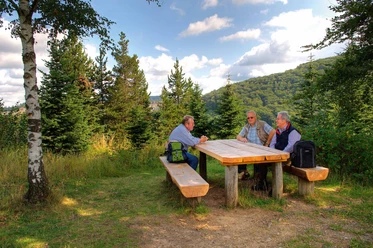
You will get answers to these and many other questions if you accompany Hanna and Luke from the Brockenbande on the Water Climate Trail around the reservoir of the pre-dam. This is a 3.3-kilometre circular trail over the dam crest around the underwater basin and back up to the dam wall of the Sösetalsperre. The starting point is the parking lot at the top of the dam, where an information board introduces the topic. At five interactive stations, questions about the function of dams, hydropower and compensation areas are addressed and conveyed in a child-friendly way using interactive elements and audio sequences.

Good to know

Best to visit

suitable
Depends on weather

Directions

Start at the parking lot at the Sösetalsperre dam. The first stop is at the top of the dam, at the end of which you turn right towards the underwater basin, initially on a forest path, then quite steeply downhill on a narrow path. The second station can be found at the end of the path. The "Water" climate trail now follows a paved road to the bridge over the Söse. Of course, there is no car traffic here. The third station is at the "Schwarze Brücke" parking lot, where there is an alternative entrance to the climate trail. Up to the dam of the underwater basin, the climate trail follows a straight forest path. It then climbs a few steps to the top of the dam of the underwater basin. If you turn your gaze to the left, the fourth station at the Bremen oak tree comes into view. There is a bench to rest under the Bremen oak tree. Here you can see the underwater basin with the swallow towers. The hydroelectric power station can also be seen here. Continue in this direction - always heading towards the gate of the hydroelectric power station. Immediately next to the gate, the climate trail runs uphill. Here - at the fence - is the final stop. Once you reach the top, you pass the hydroelectric power station and then walk a short distance on a footpath directly alongside the B498. Be careful here! There is now a small meadow orchard on the right. Once you have passed this, the path winds up the dam in four bends to the parking lot as the destination of the climate educational trail.

Equipment

Sturdy shoes are recommended.

Additional information

You can find more information about the Water Climate Trail here.

Author´s Tip / Recommendation of the author

The trail is designed for children of primary school age.

Nearby