Engagement Route hike


- 3:30 h
- 11.64 km
- 262 m
- 277 m
- 331 m
- 549 m
- 218 m
- Start: Parking lot north of the dam between the forebay and Sösetalsperre
- Destination: Parking lot north of the dam between the forebay and Sösetalsperre
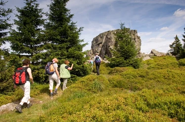
Enjoy the circular hiking trail around the Sösetalsperre to Riefensbeek and Kamschlacken past many beautiful viewpoints and small waterfalls.
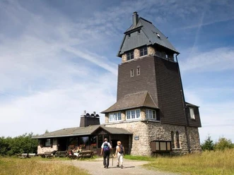
We start our route at the water of the Sösetalsperre on a flat path to Riefensbeek. Those feeling hungry or thirsty there can try the freshly baked cake or homemade tortes at Landhaus Meyer. Well strengthened, the route continues to the Eleonor shelter. From there, you have a view far down into the valley. The descent is also characterized by beautiful views and small waterfalls.

Good to know
Pavements
- Gravel (52%)Trail (31%)Path (7%)Asphalt (4%)Street (6%)
Best to visit
- suitableDepends on weather
Directions
Coming from Osterode, park your car north of the dam between the forebay and the Sösetalsperre.
We start our circular route along the water towards Riefensbeek. Once there, the hiking trail leads us left onto the path "Am alten Riefensbeek." At the next fork, it goes uphill until we have crossed the mountain meadows. At the large intersection of the small Mittelberg, the path leads steeply down again to Kamschlacken. The next destination is the Allertal. From there we follow the hiking trail to the Eleonorenblick. The path leads us uphill over the Knochenplatz along the Böseberg to the Ackerblick shelter. From there, we follow the Riefensbeek hiking trail on a narrow path across the valley floor at the Eichelnberg. From here, we keep left and go directly down into the valley. At the parking lot, we keep left, cross the dam, and reach the car directly.
Directions & Parking facilities
- Getting there
Follow the B 498 about 6 km from Osterode towards Riefensbeek-Kamschlacken. The parking lot where our route begins is on the right side.
ParkingUse the parking lot north of the dam between the forebay and the Sösetalsperre.
Public transportationTake bus line 462 from Osterode-Mitte/Stadthalle towards Riefensbeek (21M). You can also start the route at "Am alten Riefensbeek."
Additional information
- Tourist Information Osterode
Eisensteinstraße 1, 37520 Osterode am Harz
05522 318333
touristinfo@osterode.de
www.osterode.de/tourismus Author´s Tip / Recommendation of the author
Try the delicious cakes and homemade cake specialties at Landhaus Meyer or Café Sonneneck.
Safety guidelines
The path section from the parking lot north of the dam to Riefensbeek is on flat terrain and thus also suitable for wheelchair users.
Map
Osterode - Bad Grund - Clausthal-Zellerfeld - Herzberg am Harz hiking map GPS-precise Publicpress - The maps with the sun ISBN: 978-3-89920-088-1 or Harzer Hexen Stieg Official map for the recognized award-winning hiking trail in the Harz Published by the Harz Tourism Association and the Harz Club e.V. Publisher: Schmidt Buch / Cartography
Nearby

Download GPX file