- 2:30 h
- 23.48 km
- 642 m
- 642 m
- 229 m
- 612 m
- 383 m
- Start: Valley station of the Burgberg cable car, Nordhäuser Straße 2 A, 38667 Bad Harzburg
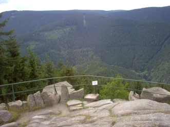
The short round route includes some steep single-trail climbs. Attention must be paid to downhill riders in these areas. On the hills and rock cliffs of the Okertal are some of the best viewpoints. After a rapid descent into the Okertal, the route runs along the edge of the Harz back to Bad Harzburg. There are also some viewpoints there, with views over the expanses of the northern Harz.

Best to visit
- suitableDepends on weather
Directions & Parking facilities
- Public transportationAbout 2 km from the station and on the south side of the town center is the valley station of the Burgberg cable car, where six MTB routes start.
Additional information
The Volksbank Arena Harz is also available on YouTube.
Map
The Harz for mountain bikers
Through the extremely varied North German low mountain landscape, 74 signposted mountain bike round routes (total length 2,300 km) lead, which are classified into three difficulty levels. Official map set "The Harz for mountain bikers". Completely revised and expanded new edition. The new map set consists of a route book with detachable individual descriptions and detailed maps of the routes. In addition, there is a topographic overview map (1:50,000) printed on weatherproof and durable POLYART material.
ISBN 978-3-935806-28-2
Price €16.80
Publisher map solutions, Karlsruhe 2017