- 1:30 h
- 5.51 km
- 78 m
- 95 m
- 560 m
- 641 m
- 81 m
- Start: Tourist Information Hohegeiß, Kirchstr. 15 a, directly on B4
- Destination: same as starting point
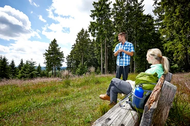
Get to know Hohegeiß and enjoy the beautiful views of the surroundings: to the north towards the Brocken massif and to the south to Thuringia, where, in good visibility, the Inselsberg 100 km away can be seen.
The path runs within the village on paved streets, outside on hiking trails and meadow paths.
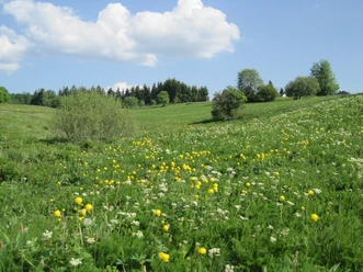
In summer, mountain flowers such as arnica, globeflower, or orchids on the meadows and in the spa park create a particularly beautiful scene.

Pavements
- Trail (7%)Asphalt (44%)Street (15%)Path (19%)Unknown (3%)Gravel (13%)
Best to visit
- suitableDepends on weather
Directions
- You follow the route symbol from the Tourist Information towards the Protestant church and turn left onto "Brockenblickstraße." At the end of this street, the paved path, on which the circular route continues, leads to the right. However, it is worthwhile to initially continue about 100 m further on the hiking trail extending from Brockenblickstraße towards Benneckenstein and enjoy the view at Brockenblick.
Then you return to the circular route and follow the former border, passing historic border stones, to "Benneckensteiner Straße." Alongside this street, the path leads again towards the church, before that downhill on Hubertusstraße and then uphill on Langen Straße to the local history museum "Alte Pfarre." Afterwards, you reach a section with a particularly beautiful view to the south via hiking trails and meadow paths.
The circular route then continues towards Hotel Panoramic and through the spa park. Passing the insect hotel, you reach Gerhart-Hauptmann-Straße up to Federal Road 4. After crossing the road, the path leads into the village and back to the starting point. Equipment
- No special hiking equipment required.
Directions & Parking facilities
- Getting thereHohegeiß is accessible via the B4, Braunlage – Nordhausen, or via the state road Walkenried - Zorge as well as via Hasselfelde - Benneckenstein.ParkingParking lot below the Tourist Information.Public transportation
Bus line 470 VSN from Braunlage (various bus lines connect here) to Hohegeiß, stop within the village: "Hindenburgstraße"
Travel by train:
- From the south: via Walkenried station or Bad Sachsa station. There is a direct transfer to bus line 470 towards Braunlage.
- From the north: via Bad Harzburg station; from there bus line 820 KVG. Via Wernigerode station: line 264 HVB. In each case to Braunlage central bus station (ZOB), there you transfer to bus line 470 VSN towards Hohegeiß.
Additional information
Tourist Information Hohegeiß Kirchstr. 15 a, 38700 Braunlage
Tel.: (05583) 241/ Fax : (05583) 1235 tourist-info@hohegeiss.de Braunlage Info
Trail sign opposite on the other side of the street
Local History Museum "Alte Pfarre" Hermann-Löns-Str. 7, Tel.: 05583/389 or 05583/241
Protestant Church "Zur Himmelspforte" Kirchstraße 7a, Tel.: 05583/834
Author´s Tip / Recommendation of the author
- At the Protestant church "Zur Himmelspforte," it is worthwhile to pause the hike and visit the beautiful church.
Safety guidelines
- Several federal and state roads are crossed multiple times. The route also leads for short stretches directly on paved roads. Special caution is required here; please watch out for traffic!