- 1:30 h
- 4.61 km
- 134 m
- 134 m
- 217 m
- 314 m
- 97 m
- Start: Info pavilion on the Bere riverbank in Niedersachswerfen
- Destination: Info pavilion on the Bere riverbank in Niedersachswerfen
First part of a triple circular route connecting the Mühlberg and Niedersachswerfen with two future sections linking the Himmelberg, the Kelle cave monument, and the towns of Woffleben, both with railway stations.
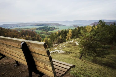
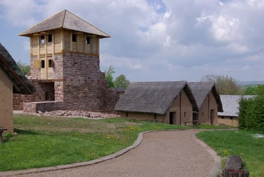
The route begins at the Info Pavilion for the HotSpot Gypsum Karst and first leads under the steep slope of the Mühlberg to the dance pond. This formerly larger sinkhole lake was unfortunately reduced by dumping in the past. Legends surround the lake lying in the winter shadow of the Mühlberg. It continues over the former extraction site of the gypsum factory Probst, which operated until 1967 and is slowly being reclaimed by the forest. The path rises steeply, following the former braking hill up to the Mühlberg plateau. Here the route turns east again with beautiful panoramic views of the Kohnstein, Niedersachswerfen, and Nordhausen.
Along an old hill fortification, the Faciusgraben, the path goes close to the upper steep edge of the Mühlberg with good views over Ilfeld and the Harz. The descent into the Bere valley leads around the former extraction site for dolomite and claystone of the Sydow and Penzolz companies, of which the latter still has some remains, including parts of the brick chimney. The start or end point at the Info Pavilion is then reached.
Information on fauna, flora, and geology is provided by information boards along the path. From the end of the path, the Niedersachswerfen DB stop is 1.6 km south and the Niedersachswerfen stop of the Harzquerbahn is only 800 m to the southeast, passing the church square.

Best to visit
- suitableDepends on weather
Directions & Parking facilities
- Public transportationFrom the end of the path, the Niedersachswerfen DB stop is reached 1.6 km to the south and the Niedersachswerfen stop of the Harzquerbahn is reached in only 800 m to the southeast passing the church square.
Additional information
Map