- 3:00 h
- 9.38 km
- 257 m
- 256 m
- 235 m
- 492 m
- 257 m
- Start: Waldhaus Oker
- Destination: Waldhaus Oker

Best to visit
- suitableDepends on weather
Directions
We begin our circular hike at the parking lot of the former Waldhaus hotel. There we cross the bridge. With some luck, you can observe a dipper searching for food in the riverbed of the Oker. Immediately behind the bridge, an information board explains the former use and development of the Oker Valley. Until 1866, timber was floated on the Oker. Since the Oker Dam regulates the water flow to protect Wolfenbüttel and Braunschweig from flooding or to balance low water levels, this would no longer be possible. From the mid-19th century, numerous wood grinding mills emerged in the Oker Valley. Although used differently in the meantime, some of the buildings formerly used for this purpose still remain. Behind the bus stop, on the opposite side of the street, we follow the Harzklub hiking trail 6J (blue triangle). Our path leads slightly uphill. To the left of the path grow garlic mustard and nettle. Both indicate nutrient-rich site conditions. While the former has fallen into oblivion, nettle is nowadays simply disliked. Yet both plants were indispensable to poor people in the past. The nutritious nettle made an important contribution to survival in times of need, as it contains more iron than spinach, more calcium than cow's milk, more vitamin C than oranges, is also very high in protein, and grows almost everywhere. Those who want to try it for themselves should grasp a leaf underneath with thumb and forefinger, fold it several times and press firmly. This destroys the stinging cells, and the "nettle candy" can be safely eaten. Garlic mustard was formerly indispensable in every herb garden, as spices like pepper and salt were luxury goods.
Steeply up to the Oker Cliffs Path
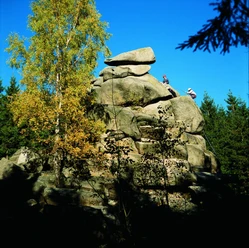
Flavouring was done with herbs. Garlic mustard Alliaria officinalis, also called garlic herb or garlic cress, belongs, like mustard Brassica nigra, to the cruciferous plants. The garlic-flavored leaves and seeds of garlic mustard are usable. When ground, the seeds served as a pepper substitute. To the right of the path, near a small stream, we can spot fire salamanders. Woodland horsetail grows where it is damp. We continue uphill and soon see a large windthrow area on the left. Naturally, deciduous trees would grow here; the shallow-rooted spruce trees are not native to the site but had been planted. Further on, we reach a crossroads where the Old Harz Road branches off to the right. It was built in 1817 according to plans by the chamber secretary von Eschwege to facilitate timber transport and to promote traffic in the Upper Harz. We remain on the main Harzklub hiking trail 6K (blue triangle) and continue uphill. After a few meters, the path turns right through a windthrow area. A very steep ascent leads us to the narrow Oker Cliffs Path and then to the impressive Ziegenrücken Cliffs. Like most of the following cliffs, they consist of white-grey Oker granite. The grey, translucent components of the rock are quartz crystals. The white crystals are feldspars; the black components belong to the mica minerals. By definition, rock is a solid mixture of different minerals. The minerals granite consists of are easy to remember: "Feldspar, quartz, and mica, I will never forget these three!" Passing the Devil’s and Students’ Cliffs, we reach the Treppenstein. At the Treppenstein is Stamp Station No. 117 of the Harzer Wandernadel.
From the Treppenstein to Romkerhall
Climbing the cliffs via the narrow, eponymous steps is worthwhile for the views alone. Various lichens inhabit the rocks, including the map lichens typical for the habitat type silicate cliffs with rock crevice vegetation. Rowan trees grow in crevices. Opposite, the Students’ Cliffs can be clearly seen; a few years ago, the Lower Saxony State Forests, supported by the Lower Nature Conservation Authority of the Goslar district, undertook extensive clearing of these and numerous other cliffs. Unnoticed, with the Treppenstein, we also enter the eastern part of the bird protection area "Cliffs in the Oker Valley". The larger part of the bird protection area lies west of the Oker between the Düsteren Tal in the north and the Romkerhalle pumped-storage power plant in the south and coincides with the FFH area "Rocks in the Oker Valley". Passing the Great Elector Cliff and further cliffs and rocks, we reach the Schöppenstedter Weg, which leads us to the Romke Cliff. From there, the water diverted from the Kleine Romke plunges about 65 m deep. The Romkerhalle Waterfall is the highest artificial waterfall in the Harz. From Romke Cliff, we look across to the opposite Raven Cliffs. On the east-facing slope visible to us, partly treeless and formed as block screes, hardened black clay slates (hornfels) occur. Here, the habitat types dry European heaths and siliceous scree slopes of the Central European mountain ranges have developed. On the west-facing slope, typical plant communities of calcareous cliffs with rock crevice vegetation can be found. We choose the steep descent into the Oker Valley. At the foot of the waterfall, the Siberian iris blooms in late spring.
Via the Engagement Island back to the Waldhaus
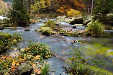
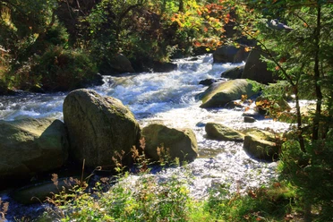
Romkerhalle as a place name was established only in 1863 with the opening of the now considerably aged inn. The name "Kingdom of Romkerhall" is a reference to the location of the house in the unincorporated Harz area, which is now managed by the Lower Saxony Forestry Office Clausthal. We take the Harzklub hiking trail 6F (red triangle) towards Engagement Island. For the now 4 km back to the starting point of our circular hike, sure-footed, closed footwear is essential. We often walk on bare rock! With some luck, you experience the Oker as a rushing wild river. This always happens when water flows through the turbines of the pumped-storage power plant during peak load times. On both sides of the path grow wood clover, wood rush, common hawkweed, and spiked devil's claw. Brown trout frolic in the river. The varied path leads us to Engagement Island (Stamp Station 116 of the Harzer Wandernadel). Shortly afterwards, we reach a reservoir that ensures all-day supply to the hydroelectric power plants below. Behind the dam, the path goes steeply downhill. The path leads us past the Marienwand. Climbing is generally allowed here, but the closure periods to protect breeding peregrine falcons must be strictly observed. Along the road, we come to the impressive Eagle Cliffs. Alongside the adventurous path, the aqueduct on stilts and partly carved through the rock fascinates above all. As during the time of the first commissioning, it serves to provide consistent water supply to the grinding mills, where nowadays only electricity is generated. Following the path along the Oker further, we return to the starting point of our hike, the Waldhaus.
Directions & Parking facilities
- Parking
At the Waldhaus Oker.
Additional information
Tourist information Goslar in the historic town hall
Markt 1
38640 Goslar
Tel: 05321 78060
marketing@goslar.de