Over the Achtermann into the Hochmoore

- 2:50 h
- 10.25 km
- 262 m
- 216 m
- 754 m
- 920 m
- 166 m
- Start: Königskrug, at the bus stop
- Destination: Torfhaus, at the bus stop
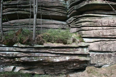
From the Braunlage settlement Königskrug at approx. 750 m height, the route initially follows a wide forestry road (the "Milliardenweg") heading north. After the first ascent, we leave it and turn right along a rocky path past the Achtermanns-Brunnen towards the foot of the Achtermann. From the shelter there, you climb over high stone blocks and with a railing to the geologically remarkable summit of the Achtermannshöhe at 925 m.
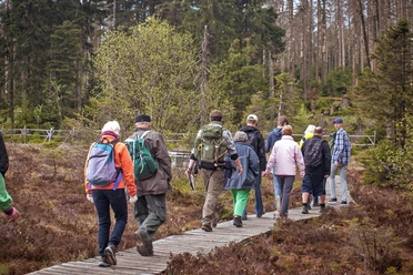
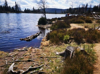
After enjoying the wide view, there is a short but steep descent to the east down to the Warme Bode, at around 800 m above sea level. We follow this still rather small watercourse through the Harz Hochmoor landscape to its source at Bodebruch with the viewing platform and explanation board Moors in the Harz National Park.
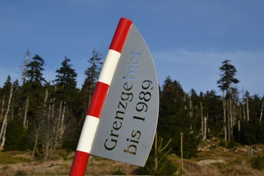
Soon after, we reach the Dreieckiger Pfahl, an ancient boundary point at 870 m altitude.
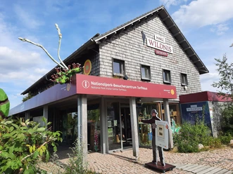
Along the wide forestry road "Schierker Straße" we go to the junction of the Kaiserweg and turn right onto the hiking trail, which passes the granite boulder weathering rocks of the Hopfensäcke. The path itself is characterized by Harz granite. Soon after two turns, we reach the Goetheweg or Harz Hexenstieg, which we follow westwards along the Abbegraben, a moor water-filled diversion ditch that is part of the UNESCO World Heritage Site Upper Harz Water Management System, to our endpoint Torfhaus. The Harz National Park operates a visitor center there.
There are dining facilities in Torfhaus.

Good to know
Pavements
Best to visit
Directions
From Königskrug mark 31H (green triangle) to Achtermann, approx. 2 km.
From Achtermann mark 35L (red dot) to Dreieckiger Pfahl, approx. 3.5 km; shortly before you reach the Hochmoore viewing platform on the left side.
From Dreieckiger Pfahl mark 35E (blue dot) via Hopfensäcke cliffs and Kaiserweg to Goetheweg, approx. 2 km.
From Goetheweg mark 10F (blue triangle)/Hexenstieg follow it to Torfhaus, approx. 2.5 km.
Equipment
Sturdy footwear is required due to many stony sections. Additionally, many boggy path areas can be wet and muddy.
Because of the climatic conditions in the high altitudes of the Harz, wind- and cold-resistant clothing is recommended.
No dining possibilities en route, but rest areas and viewpoints invite you to linger; therefore, backpack provisions are recommended. At the end of the tour in Torfhaus, gastronomic services are available.
Directions & Parking facilities
By bus: boarding in Braunlage at various stops of line 820 Braunlage-Bad Harzburg.
By car: From Braunlage onto the bypass/B4 towards Bad Harzburg. From the Braunlage Mitte exit after about 4 km arrival in Königskrug.
Return from Torfhaus should generally be done by bus, as the route is not a circular path. Start and end points are well connected by the bus service.
From Braunlage take line 820 (direction Bad Harzburg) to Königskrug.
Return from Torfhaus with the same line direction Braunlage.
The bus runs hourly on this route.
Additional information
The route is only recommended or possible on snow-free days.
Stamp points of the Harzer Wandernadel on this route are located at Achtermann (#12) and Dreieckiger Pfahl (#168). Near Torfhaus, there is also a special stamp point (#9943) at the Waldwandelweg on Schubenstein.
Author´s Tip / Recommendation of the author
The mountain summit of Achtermann offers a magnificent panoramic view over the Harz.
Experience the Upper Harz Hochmoore with unique vegetation. Explanations are provided at the viewing platform at Bode-Bruch.
Impressive forest regeneration in the high elevations of Harz National Park accompanies the entire hike.
Historical features like Dreieckiger Pfahl with DDR border pillar, Abbegraben as part of the UNESCO World Heritage Site Upper Harz Water Management System.
Geological peculiarities due to the granite-shaped rock landscape.
Safety guidelines
The route passes over some very rocky sections.
The ascent to the summit of Achtermann is very steep with high stone steps; it can also be very windy at the summit.
Nearby