Steinbock circular route

- 2:10 h
- 8.06 km
- 115 m
- 115 m
- 192 m
- 307 m
- 115 m
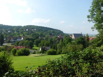
The destination is the intersection point 52° north latitude with 10° east longitude. The starting point is the parking lot in Hellegrund from where, following the signposts, we soon hike northward through the “Hartlah”. A narrow path lined with spruces leads to a forest trail which we follow northeast until the forest edge. Here we enjoy the view of the towns of Wöllersheim and Neuhof as well as the hilly forest area of the “Harplage”.
Next, we turn left, thus heading west, passing through a valley and then uphill along the forest edge to the destination point. At this point, one should read the information board and take a rest on a bench under the spruces. For the return, either take the same path or along the opposite forest edge below the "Sauberge" to the K317. After about 100 m on the district road towards Wöllersheim, turn right onto a field path uphill to the forest edge. Then continue southward through the forest or along the forest edge, past an abandoned quarry, gently ascending, over a wooden footbridge across a ditch and through an overgrown path to the next forest edge trail. On this, we proceed until we reach our starting point, Hellegrund, again.
It is advisable to take the Lamspringer hiking & leisure map along as an aid for orientation.


Good to know
Best to visit
- suitableDepends on weather
Nearby
Download GPX file