- 3:30 h
- 11.42 km
- 510 m
- 510 m
- 627 m
- 1,137 m
- 510 m
- Start: National Park House Schierke, 38879 Schierke
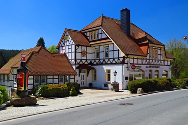
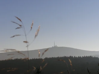
The path from Schierke through the Eckerloch to the Brocken is one of the most traditional and popular hiking trails in the Harz. Our hike begins at the National Park House Schierke at the western exit of the town directly on Brockenstraße. Before your hike, don't miss the chance to get information here in the exhibition or from the National Park Rangers about the trails to and weather on the Brocken.

Best to visit
- suitableDepends on weather
Directions
After initially hiking a short stretch on Brockenstraße, we turn right after the waterworks and crossing the Schwarzes Schluftwasser and follow the signposting "Brocken via Eckerloch". In the valley of the Schwarzes Schluftwasser ("Schluft" from gorge) the path becomes steeper and rockier. The stream springs from a spring bog on the southern slope of the Brocken.
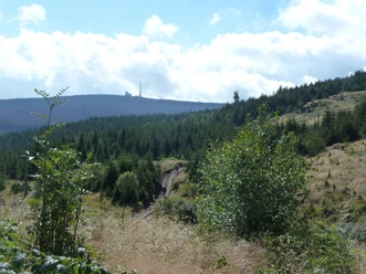
Up to the crossing of the Brocken railway, we hike through forests that were once planted by humans and used until the recent past. More than 2000 years ago, the first forests in the Harz were cleared to supply mining and smelting works with wood and charcoal. Natural forests could no longer meet the increasing demand for wood and had to give way to forests almost exclusively consisting of fast-growing spruces. Since the designation of the National Park, these commercial forests have been developing again into near-natural mountain mixed forests. Deciduous trees, such as beech in the lower areas and mountain maple or rowan in the higher locations, are to reclaim their ancestral places. However, due to heavy bark beetle infestation, it will take many years until dead spruces are replaced by a near-natural mixed forest. Occasionally, human assistance in the form of forest development measures by the National Park is necessary.
After crossing the Brocken railway line, it is not far to the shelter at the Eckerloch. Before the steep ascent via the Eckerloch climb, it is advisable to take a break here. The path now leads uphill over partly large stones. Completely untouched primeval forests no longer exist in Central Europe. However, there are a few remnants of still very near-natural forests, including the 1000-hectare forest on the upper slopes of the Brocken. The harsh climate, low tree growth, and difficult accessibility largely spared this forest from axe and saw. The dead wood now provides habitat for fungi, insects, and animals. Ferns and grasses dominate the ground flora.
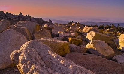
After reaching Brockenstraße, which we turn left onto, the forest becomes even sparser until only a few bizarre tree shapes withstand the increasingly strong wind. At about 1,100 m above sea level (NHN), we reach the forest boundary on the Brocken. This is particularly valuable for nature conservation as the northernmost natural forest boundary in Central Europe. As Germany's windiest mountain, the Brocken is characterized by a particularly harsh climate. The average annual precipitation is about 1,600 mm, and the annual mean temperature is around 4 °C. Due to this exceptional climate, the Brocken, as the only elevation of the German Central Uplands, has a treeless summit. A shrub and grass-rich mountain heath spreads here.
Once at the top, we recommend visiting the Brockenhaus, which is open daily as a National Park House. With its numerous exhibits, it provides information about the Harz National Park, flora, fauna, and geology, as well as the eventful history of the mountain. Further information about the Brocken summit can also be found in the brochure "The Brocken in the Harz National Park".
The return route is on the same trail. Alternatively to the Eckerloch climb, it is also possible to take the about two kilometers longer but easier descent via Brockenstraße to the Mönchsstein and from there back to Schierke via "Alte Bobbahn" and "Neuen Weg." On this route, a short detour from the trail onto the primeval forest path into the Brocken primeval forest is recommended. Overall, this hike covers an ascent of about 500 meters on partly steep and rocky and root-rich paths. Good footwear is absolutely necessary.
Directions & Parking facilities
- Parking
Brocken parking lot Schierke, Brockenstraße 56a, 38879 Wernigerode
Public transportationBus stop at Café Winkler, Brockenstraße 33, 38879 Wernigerode
Additional information
National Park House Schierke
Tel. 03 94 55 / 4 77, www.nationalpark-harz.deBrockenhaus, Tel. 03 94 55 / 5 00 05,
www.brockenhaus-harz.deTourist Information Schierke am Brocken
Tel. 03 94 55 / 86 80, www.schierke-am-brocken.de