- 10:00 h
- 34.42 km
- 325 m
- 664 m
- 461 m
- 805 m
- 344 m
- Start: Torfhaus
- Destination: Königshütte
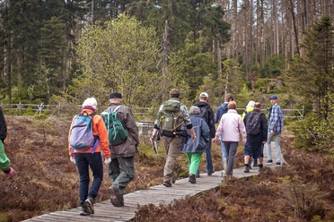
From Torfhaus to the Brocken, you already know that? The path is too strenuous for you? The mountain does not show itself from its harsh side, namely not at all? Or there are simply too many people on the way? Then take the alternative! The Brocken bypass is by no means a second choice. Away from the bustle of the mountain, it continues along rustic trails through the Harz National Park. Along boardwalks we ascend along the Oderteich, once the largest and oldest reservoir in Germany. It is dammed by a "Cyclopean dam" made of huge granite blocks. The water from the pond is transported by the Rehberger Graben to St. Andreasberg. Where it used to be used for mining, it now drives turbines in the Samson mine and generates environmentally friendly electricity for the residents. The open mountain meadows around the free mountain town, which stretch almost to Braunlage, are a feast for the eyes, especially in summer. The Oder Valley deeply cuts the connection between the two towns. But not narrowness and gloom, but light and splendor also characterize the picture here. In Braunlage, a tourist center in the Upper Harz, the path leads directly past the foot of the Wurmberg. From here a cable car runs to Lower Saxony's highest peak. The view is breathtaking. Not only of the Brocken summit directly opposite but over the entire southern mountain range. Below the Wurmberg, the world once ended here as well. We cross the former inner-German border at the crossing over the Bremke, the former border stream. Now we are in the once inaccessible border area. At Elend we reach a settlement again and encounter the Bode River for the first time. Here it is the Kalte Bode, whose course we follow to the idyllic hamlet of Mandelholz, then immerse ourselves again in the bright forest that accompanies us to Königshütte. Earlier, at the rest area in the Steinbachtal, we encounter the Brocken hikers of the Harzer-Hexen-Stieg.
Best to visit
- suitableDepends on weather
Directions
- It branches off south from Torfhaus and leads through the Harz National Park along the oldest reservoir in Germany, the Oderteich. On the Rehberger Grabenweg we reach the old mining town of St. Andreasberg. Through the blooming mountain meadows the path continues, descends into the Oder Valley and then rises again to Braunlage. The winter sports center in the heart of the Harz is also popular and lively in summer.
At the Bremke we cross the former inner-German border on the way to Elend and then reach the foreland of the Bode reservoir system with the flood protection basin near Mandelholz. In the idyllic Steinbach valley, just before Königshütte, the Brocken bypass meets the main path again. Literature
- KartoGuide Harzer Hexen-Stieg Official guide with map (1:30,000) Authors: Hans Bauer & Dr. Stefan Krooß Publisher: Harzer Tourismusverband & Harzklub Publisher: Schmidt-Buch-Verlag, Wernigerode ISBN-10: 3936185336 ISBN-13: 978-3936185331 Price: €6.80
Map
- Harzer Hexen-Stieg 1 : 30,000: Official map of the recognized premium hiking trail in the Harz. Publisher: Harzer Tourismusverband & Harzklub Publisher: Schmidt-Buch-Verlag, Wernigerode ISBN-10: 3936185328 ISBN-13: 978-3936185324 Price: €5.50