Natura Tip 12 - Gypsum Karst Area near Bad Sachsa - Route 1 (Walkenried)

- 1:19 h
- 4.78 km
- 92 m
- 92 m
- 258 m
- 332 m
- 74 m
- Start: Walkenried Abbey
- Destination: Walkenried Abbey

Good to know
Best to visit
- suitableDepends on weather
Directions
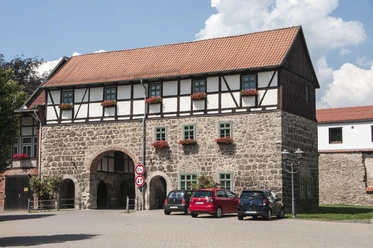
Our hike begins at the parking lot of Walkenried Abbey. We follow the marked circular route of the Karst hiking trail and the Wieda river. Along its banks, the primarily protected habitat type floodplain forests, specifically alder and ash forests by flowing waters, is easy to recognize. We continue: We keep parallel to the railway line, which runs on the left-hand side. Even before reaching the forest, we notice an unusually high number of hazel bushes. Their presence has been deliberately promoted for a long time. Not only for the nuts; the straight and flexible rods were a sought-after material for fence building and basket weaving. A thick, partially dead beech tree marks the entrance to the Himmelreich. Unfortunately, how this field name came about has been forgotten. The Himmelreich is part of the Itelteich nature reserve, belonging to the FFH area. On steep slopes characterized by numerous sinkholes, a woodruff-beech forest grows here. Gypsum is present underground. From the path, we always have a good view of the Itelteich situated in a basin. Anyone who thinks they recognize a natural karst lake here is both right and wrong. Because this naturally water-filled hollow with underground drainage was also artificially dammed by the monks of Walkenried. We first follow the signage of the Harz Club towards Ellrichblick (Hexentanzplatz). Once at the ridge trail, we discover where the railway line leads, which ran parallel to our path. It runs directly beneath us through one of Germany's largest natural cavities. It is the Himmelreich cave. Its center is marked by a rail driven into the ground on the way to Ellrichblick.
At the viewpoint, which should not be confused with the much better-known Hexentanzplatz near Thale, the stamp station No. 167 of the Harz hiking badge awaits us along with a breathtaking view of the South Harz region and Ellrich. It is the northernmost town of the Free State of Thuringia. For almost four decades, this view of their home town was denied to the people of Ellrich. What is now called the “Green Belt” as a natural refuge for rare animal and plant species and runs directly in front of us as a strip of greenland was long known as the so-called “death strip” – the former inner-German border. Back on the main path, we follow the way to the Tlusty hut. Our path is accompanied by a very old stand of beech trees with individual trees older than 250 years. What appears untidy is a sign of great naturalness. Countless different insect species live in the decayed trunks. Insects and their various developmental stages are an important food source for bats, woodpeckers, and numerous other species. While on the opposite slopes, on the steepest parts, a sun-demanding Central European orchid-calcareous beech forest grows, here on the consistently shaded slopes there is a gorge and slope mixed forest. The beech tree is partly deprived of its dominance; noble deciduous woody species have mixed in. Because the gypsum rock underground is well water-soluble, there are repeated landslides on the steep slopes. The bare rock can only be settled by specialists. These slope sections are assigned to the habitat types calcareous scree slopes and calcareous cliffs with fissure vegetation. Our path leads us further into the meadow of the Wieda and from there continues along the river back to Walkenried Abbey.
Directions & Parking facilities
- Parking
Parking options at Walkenried Abbey.
Additional information
Tourist Information Walkenried
Steinweg 4
37445 Walkenried
Tel. +49 5525 9989000
info@walkenried-tourismus.de
www.walkenried-tourismus.de
Nearby


Download GPX file