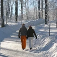
Leichte, familiengerechte Streckentour mit Einkehrmöglichkeit.
Richtung Kloberbergbaude-Brandholzstraße-Adlereiche-Hohle Eiche-Sellbachweg-Allrode
Hauptstraße 116
06502 Thale OT Friedrichsbrunn
Tel. 039487 287
friedrichsbrunn@bodetal.de
www.bodetal.de
Leichte, familiengerechte Streckentour mit Einkehrmöglichkeit.
"},{"@type":"PropertyValue","name":"teaser","value":"Leichte, familiengerechte Streckentour mit Einkehrmöglichkeit."},{"@type":"PropertyValue","name":"ROUTE_HOEHENMETER","value":29},{"@type":"PropertyValue","name":"ROUTE_HOEHENMETER_DESC","value":103},{"@type":"PropertyValue","name":"SYSTEMID_outdooractive","value":"6135191"},{"@type":"PropertyValue","name":"license","value":"CC-BY-SA"},{"@type":"PropertyValue","name":"licenseurl","value":"https://creativecommons.org/licenses/by-sa/4.0/deed.de"},{"@type":"PropertyValue","name":"SnowReportTrackState","value":"OPEN"},{"@type":"PropertyValue","name":"highlight","value":false},{"@type":"PropertyValue","name":"area","value":"Harz"},{"@type":"PropertyValue","name":"area","value":"Harz für Hahnenklee"},{"@type":"PropertyValue","name":"eT4","value":60},{"@type":"PropertyValue","name":"Panorama","value":60},{"@type":"PropertyValue","name":"Kondition","value":20}],"address":{"@type":"PostalAddress","addressLocality":"Thale","postalCode":"06502","streetAddress":"","addressRegion":"Harz","addressCountry":"Deutschland"},"amenityFeature":[{"@type":"LocationFeatureSpecification","name":"Familienfreundlich","value":true},{"@type":"LocationFeatureSpecification","name":"Einkehrmöglichkeit","value":true},{"@type":"LocationFeatureSpecification","name":"duration","value":89,"unitCode":"MIN"},{"@type":"LocationFeatureSpecification","name":"totalAscent","value":29,"unitCode":"MTR"},{"@type":"LocationFeatureSpecification","name":"totalDescent","value":103,"unitCode":"MTR"},{"@type":"LocationFeatureSpecification","name":"elevationMax","value":511,"unitCode":"MTR"},{"@type":"LocationFeatureSpecification","name":"elevationMin","value":408,"unitCode":"MTR"},{"@type":"LocationFeatureSpecification","name":"difficulty","value":"easy"},{"@type":"LocationFeatureSpecification","name":"rest_stop","value":true}],"geo":{"@type":["GeoCoordinates","GeoShape"],"latitude":51.68415,"longitude":11.02524,"line":"51.68415 11.02524 51.68451 11.02452 51.68527 11.0229 51.68538 11.02237 51.6854 11.02201 51.68537 11.02137 51.68514 11.01802 51.6851 11.01687 51.68514 11.01634 51.68523 11.01589 51.68532 11.01524 51.68542 11.01427 51.68547 11.01404 51.68552 11.01386 51.68559 11.01369 51.68574 11.01339 51.68633 11.01237 51.68662 11.0118 51.68689 11.01142 51.6872 11.01092 51.68773 11.00988 51.68804 11.00938 51.68831 11.0088 51.68859 11.00788 51.68864 11.00764 51.68866 11.00745 51.68865 11.0071 51.68867 11.00673 51.68871 11.00648 51.68887 11.00595 51.68936 11.00477 51.68944 11.00461 51.6895 11.00449 51.68967 11.00426 51.69 11.00387 51.69015 11.00372 51.69055 11.00321 51.69069 11.00302 51.69076 11.00288 51.6908 11.0027 51.69087 11.00177 51.69093 11.00153 51.69111 11.00124 51.69111 11.00109 51.69112 11.00071 51.69116 11.00004 51.69135 10.99849 51.69145 10.99808 51.69212 10.99609 51.69261 10.99478 51.69244 10.99476 51.69198 10.99476 51.69173 10.99466 51.69119 10.99421 51.69113 10.99368 51.69109 10.993 51.69095 10.99225 51.69077 10.99169 51.69056 10.99135 51.6904 10.99101 51.69035 10.99053 51.69034 10.98965 51.68967 10.98777 51.68895 10.98563 51.68865 10.98477 51.68855 10.98472 51.68839 10.98468 51.68815 10.98467 51.68803 10.98465 51.68794 10.98459 51.68783 10.98446 51.68752 10.98361 51.68742 10.98344 51.68729 10.98326 51.6872 10.98317 51.68703 10.98308 51.68674 10.98328 51.68561 10.98385 51.68552 10.98387 51.68539 10.98386 51.68531 10.98379 51.68513 10.98352 51.68488 10.98308 51.68477 10.98251 51.68475 10.98179 51.68458 10.98226 51.68452 10.98268 51.68454 10.9829 51.68458 10.98311 51.68465 10.98339 51.68472 10.98354 51.68465 10.98339 51.68458 10.98311 51.68454 10.9829 51.68452 10.98268 51.68458 10.98226 51.68475 10.98179 51.68482 10.98099 51.68479 10.98035 51.68458 10.9793 51.68434 10.97834 51.68421 10.97772 51.6841 10.97714 51.68405 10.97668 51.68404 10.97625 51.68408 10.97575 51.68412 10.97554 51.6842 10.97524 51.68424 10.97513 51.6843 10.975 51.6844 10.97486 51.68428 10.97476 51.68408 10.97411 51.68396 10.9739 51.68381 10.97377 51.68365 10.97367 51.68354 10.97363 51.68347 10.97362 51.68331 10.97363 51.68312 10.97373 51.68267 10.97433 51.6826 10.97435 51.68243 10.97425 51.68239 10.97419 51.68227 10.97389 51.6821 10.97326 51.68201 10.97289 51.68174 10.97161 51.68151 10.97072 51.68141 10.97044 51.68123 10.97017 51.68049 10.96935 51.68029 10.96917 51.68017 10.9691 51.68003 10.96905 51.67967 10.96897 51.67944 10.96888 51.67928 10.96871 51.67912 10.96844 51.67908 10.96832"},"author":{"@type":["Organization"],"name":" Harzer Tourismusverband","url":"","address":{"@type":"PostalAddress"}},"dateCreated":"2024-06-12T09:52:00+02:00","dateModified":"2025-04-17T09:14:00+02:00","keywords":"robots_noindex,import_source_tta-outdooractive,import_sourceid_6135191","license":"https://creativecommons.org/licenses/by-sa/4.0/","provider":{"@type":["Organization"],"identifier":["100295747"],"name":"destination.one","url":"http://destination.one/"},"sourceOrganization":{"@type":["Organization"],"name":" Harz: Magische Gebirgswelt","url":"http://www.harzinfo.de/","address":{"@type":"PostalAddress"}}},"1":{"@context":"http://schema.org","@type":["SportsActivityLocation","WebPage"],"potentialAction":{"@type":["MoveAction","ExerciseAction"],"fromLocation":{"@type":["Place"],"name":"Parkplatz Richtung Allrode/Güntersberge"},"toLocation":{"@type":["Place"],"name":"Allrode"},"distance":{"@context":"http://schema.org","@type":["Distance","QuantitativeValue"],"value":5554,"unitText":"MTR"}},"description":"Richtung Kloberbergbaude-Brandholzstraße-Adlereiche-Hohle Eiche-Sellbachweg-Allrode
Leichte, familiengerechte Streckentour mit Einkehrmöglichkeit.
"},{"@type":"PropertyValue","name":"TourMoreInfos_directions","value":"Richtung Kloberbergbaude-Brandholzstraße-Adlereiche-Hohle Eiche-Sellbachweg-Allrode
"},{"@type":"PropertyValue","name":"TourMoreInfos_additionalInformation","value":"Bodetal-Information Friedrichsbrunn
Hauptstraße 116
06502 Thale OT Friedrichsbrunn
Tel. 039487 287
friedrichsbrunn@bodetal.de
www.bodetal.de
Beste Jahreszeit
Leichte, familiengerechte Streckentour mit Einkehrmöglichkeit.
Richtung Kloberbergbaude-Brandholzstraße-Adlereiche-Hohle Eiche-Sellbachweg-Allrode
Bodetal-Information Friedrichsbrunn
Hauptstraße 116
06502 Thale OT Friedrichsbrunn
Tel. 039487 287
friedrichsbrunn@bodetal.de
www.bodetal.de
Sie benutzen offenbar den Internet Explorer von Microsoft als Webbrowser, um sich unsere Internetseite anzusehen.
Aus Gründen der Funktionalität und Sicherheit empfehlen wir dringend, einen aktuellen Webbrowser wie Firefox, Chrome, Safari, Opera oder Edge zu nutzen. Der Internet Explorer zeigt nicht alle Inhalte unserer Internetseite korrekt an und bietet nicht alle ihre Funktionen.